North of Arnaia and at a distance of about 2 kilometers stands the conical hill of Prophet Elias (altitude 688 m.), at the top of which the namesake chapel is built.
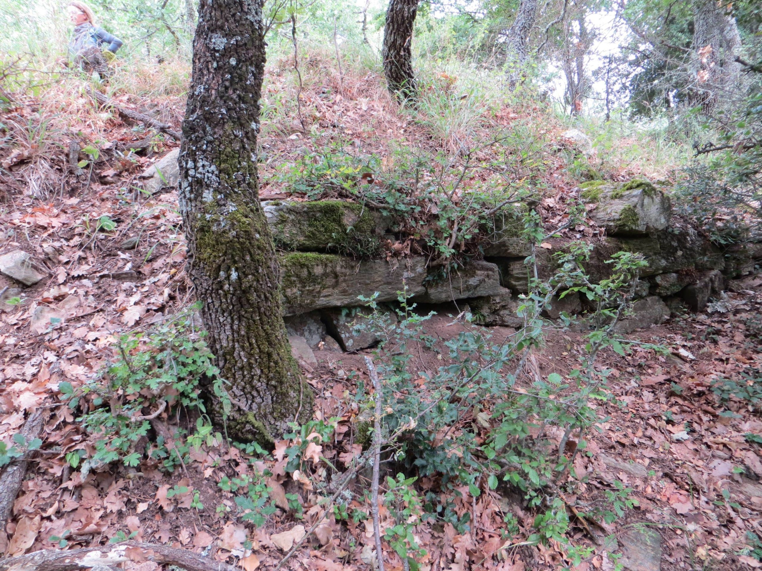
Remains of walls from the classical period (5th – 4th century BC) and the Byzantine period are preserved on this hill. The classical antiquities are found at the base and on the slopes of the hill, while the Byzantine ones are found at the top of the hill, where the remains of the medieval wall are preserved. The wall was built along the edge of the plateau at the top of the hill, with stones that had already been used in earlier building phases and covers an area of 2.200 square meters. It was built of mud and only some stones were sporadically bedded with lime mortar on its outer face.
North of Arnaia and at a distance of about 2 kilometers stands the conical hill of Prophet Elias (altitude 688 m.), at the top of which the namesake chapel is built.
Remains of walls from the classical period (5th – 4th century BC) and the Byzantine period are preserved on this hill. The classical antiquities are found at the base and on the slopes of the hill, while the Byzantine ones are found at the top of the hill, where the remains of the medieval wall are preserved. At the base of the hill and around the perimeter, sporadic remains of its fortification made of decomposed granite are found, built according to the pseudo-isodomic system.
This area is identified by some historians as the site of the ancient city “Arnae”, or “Avgaia” by others. The city of “Arnae” is mentioned by Thucydides only once (Thucydides IV, 103), when the Spartan general Brasidas marched against Amphipolis, starting from Arne, on a winter day with light snowfall and arrived about dusk at “Aulon and Bormiscus”, the region of present-day Rentina. Nothing else is known about the city; neither when, nor by whom it was founded.
The 10th Ephorate of Byzantine Antiquities conducted intensive excavations in the archaeological site of the hill of Prophet Elias, which lasted from September 15 to December 5, 2003. The excavation research was carried out under the direction of the archaeologist Ioakeim Papangelos. During the excavation, the medieval fortification was fully revealed. The wall was built along the edge of the plateau at the top of the hill, with stones that had already been used in earlier building phases and covers an area of 2.200 square meters. It was built of mud and only some stones were sporadically bedded with lime mortar on its outer face.
It is an irregular circle in plan. The perimeter of the fortification enclosure is approximately 180.00m, the wall thickness ranges from 1.20m to 1.85m and its height must not have exceeded 5.00m. The main gate is located on the south side of the wall. Its opening is 2.05m and it would close with two heavy wooden door leaves about 12cm thick, which were destroyed by fire.
There is a second, narrow gate, for people only, on the northwest side of the fortification, protected by a turret, which must have led to the nearby stream that served their needs for water. The walled opening of an older gate can be seen next to it. The upper surviving surface of the enclosure slopes slightly downwards to the outer face, along its entire length.
Approximately in the middle of the fortified settlement and a little to the east, part of a building of the settlement was identified during the excavation, but the evidence we have regarding its typology and use is insufficient. The excavator assumes that it might be the temple.
The settlement appears to have flourished during the 3rd and 2nd centuries BC and prospered once again during the 3rd – 4th centuries AD. These periods were probably associated with the mining activity in the area, which is rich in silver and gold-bearing minerals. The multitude of stone grinders is an indication of this activity, which were shredded and used as building material in the wall and the houses of the medieval settlement.
The Roman settlement survived until the 5th century AD and was possibly destroyed during the early Christian period. From the excavation evidence so far recovered, it would appear that a Byzantine settlement was also established on the hill of Prophet Elias, in a restricted part at the top, around which the medieval wall was built.
The current building remains, which are found within the fortified enclosure, suggest that the settlement was inhabited until the 14th century and was destroyed by fire. The architectural fragments of the site do not allow conclusions to be drawn about its precise form and use. We consider it likely that it was destroyed around the middle of the same century, when Chalkidiki was a major theater of military conflict and many of its villages were ravaged. The establishment of the dependency of the Athonite Kastamonitou Monastery in “Raligovi”, which evolved into the village of Liarigovi (Arnaia), could have been a result of the destruction of the fortified settlement of the Prophet Elias.
Kleanthis Doukas
archaeologist, Ephorate of Antiquities of Chalkidiki and Mount Athos
Address: Konstantinoupoleos 5,
631 00 Polygyros Halkidiki
Phone: +30 23710 22060
Fax: +30 2310 251892
Mount Athos Technical Office
Address: 7 Hippodrome Square, Thessaloniki
Phone: +30 2310 285163
Fax: +30 2310 251892
E-mail: [email protected]
